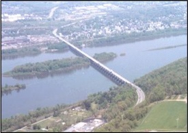
 Navarro & Wright Consulting Engineers, Inc. provided primary control for aerial mapping and conducted additional topographic survey to supplement aerial mapping, which included location of utilities, bridge underpasses, road cross-sections, and other salient features. Navarro & Wright was also responsible for location of rights-of-way and boundary surveys for right-of-way takings. This Project included coordination of lane closures for traffic control and utility mapping and coordination for numerous utilities and structures. The approximate length of roadway included in this project is 3.2 miles. Navarro & Wright also performed preliminary design for a 150-foot extension to a 12 X 20 foot box culvert over Laurel Run. This design included the connection to the existing structure and coordination with utilities and Sewer Authority for numerous relocations.
Results:
The project mapping and utility coordination was performed expeditiously to meet deadlines for all related parties to perform work activities for design and permitting submittals.